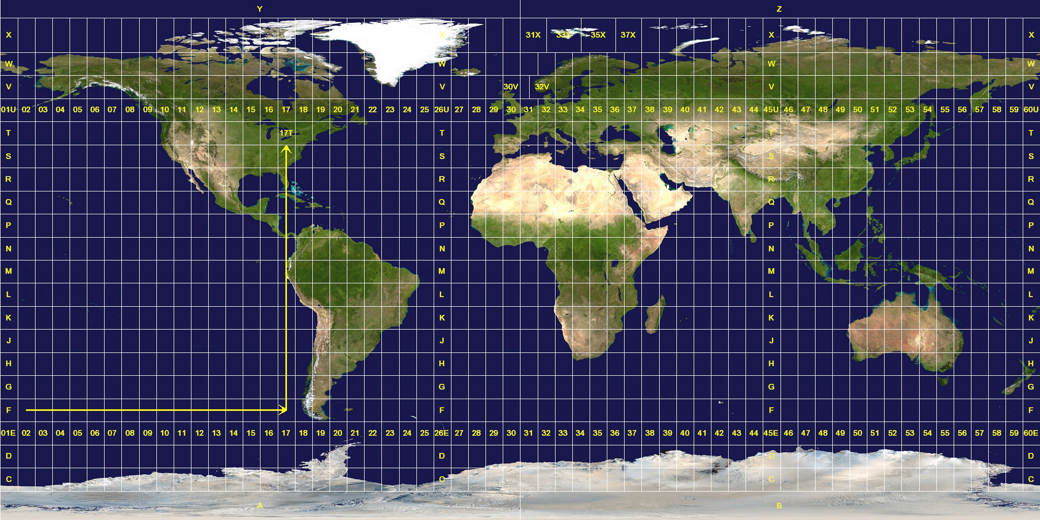
Well I've been working on understanding coordinate projections. So any comments on my current understanding is welcome. Okay, so I think of projected coordinates as two dimensional or a flat piece of paper. Geographic projected coordinates as three dimensional or spherical and round. UTM or Universal Transverse Mercator I find to be one of the more confusing geographic projections. UTM however is the standard for all Federal Agencies so it's not going anywhere. It's roots lie more in a earth based two dimensional system (Catesian coordinates) and deals more with horizontal representation and from my understanding neglects the earths poles.
There are different datums for which all different projections of coordinates are based on. The old datum model, the current datum model and similar datum models. NAD 27 (North American Datum 1927) was created using the Ellipsoid Clarke model of 1866. The center of NAD 27 is on Meades Ranch in Kansas. NAD 83 which is more current and created using the earth centered model of Ellipsoid GRS80. WGS 84 (World Geodetic System) aligns perfectly with NAD 83 both of these models were created using newer satellite technology and agree on the earth's spherical center point. I think this is important because the earth is not a perfect sphere and surface altitude comes into play when considering surface location. The older datum model NAD 27 when aligned with newer models is off by about 150 - 200 feet. WGS 84 is most commonly used in our GPS units.

No comments:
Post a Comment