Monday, December 13, 2010

Hope for a White Christmas


         Found this map to be interesting because we are so close to Christmas.  Pennsylvania, where we live, appears to be in mostly an 11-25 percent chance class for having a white christmas.  Just at a glance the bands of probability are fairly even across the nation until you hit the Rockies.  I'm thinking this would be classified as a Dasymetric thematic map like the plant zone map I blogged about in November.  Here is a link to a description this type of map.  There are other interesting maps realating to the holidays in this blog where I found the above map.  I plan on maintaining this blog beyond this class assignment as primarily a hiking blog and secondarily about hiking GPS units.  Merry Christmas and happy holidays to everyone!

Sunday, December 12, 2010

GPS Trimble GeoXT


          Well I got a chance to try out one of the Trimble GeoXT GPS units that we have in the lab for the first time today.  I found the device and software to be intuitive to use.  The application TerraSync found in the start menu is used to log GPS position coordinates.  The GPS unit itself has a wide variety of programs for you to use.  The device like many of our smart phones these days is more of a hand held computer.  In this case the operating system is Windows Mobile.
          Once you start TerraSync there are five main functions made available to you.  Map, Data, Navigation, Status, and Setup.  Map function I think is where you can upload a map as a background and navigate on.  Did not get a chance to explore the Map function.  Data function is the one that allows you to log such things as a point (similar to Garmin waypoint), a line (similar to Garmin Tracks), and area.  I did points of trees and telephone poles.  I also did a line of a sidewalk and an area of my house.  Navigation appears to get you to a stored feature.  Status is the first thing you see when you turn TerraSync on.  It is a sky map of the satellites.  You can set how accurate you want the device with a slider bar.  Another option which is very helpful is a satellite planner to give you your best times to get your chore at hand done.  The last function is Setup which includes all the coordinate systems their units and logging intervals.
          It was interesting using one of these units for the first time.  I do not think it would be a replacement for a purposefully hiking GPS though.  They are on the heavy side, have a unit specific battery and require a cradle for charging.  Most hiking GPS units use two universal easy to find AA batteries.  It was really neat though to see that the I was within a foot or two of accuracy!  The problem that really frustrated me was that I could not get the data off of the unit and into my ArcMap.  One of the options in the Data function is a file manager where you can save your data as a shapefile.  I was unable however to sync the unit to my computer.  Hopefully I'll have a solution to this soon.

Friday, December 10, 2010

Hikes: Two To Share

           These are two hikes I took before it got really cold out and did not post.  They are both in the area referred to as "South Mountain" and to get to these from Harrisburg head south on 81 towards Carlisle. The first hike is Whiskey Springs.  This is a hike on a portion of the Appalachian Trial.  A very nice hike along some interesting stone boulders jutting up along a ridge line.  There are a couple spots to find a view but for the most part you are under tree cover.  This combination makes for a fun hike.  The Appalachian Trail in red and my path in blue are different.  I think this is because there are two paths you can follow.  The trail starts on Whiskey Spring Road.  If you want to continue on the Appalachian Trail beyond where I turned around to Mountain Road it would be approximately a hour one way hike if you have a pick up or another waiting car.


Whiskey Springs - lat 40.09800 lon -77.12900


          Tumbling Run is the second hike it is further south and near Pine Grove State Park.  This hike is quite unique.  After parking off of route 233 you follow a tumbling stream to the top of the ridge line.  Their are many pools and waterfalls along the steep hike to the top.  Round trip the hike is about a hour and half depending on how long you choose to spend at the top crawling over the different boulders looking at the spectacular view.

Tumbling Run lat 40.00232 lon -77.36045


Overview of the Two Hikes


Happy Hiking!

Thursday, December 9, 2010

Stop Spinning

          I had never really thought about it before but what if the Earth stopped spinning?  I paused for a moment to think about it before I continued reading the information I had come across.  My guesses to what may happen were not even close.
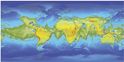
          If the Earth stopped we would have one big super continent around the middle of the Earth.  The forces created by spinning flattens the Earth at the poles giving the Earth a shape of an oblate spheroid (a difference of about thirteen miles).  More importantly the oceans which are deeper around the equator, possibly up to five miles deeper, would rush towards the poles leaving us with a land ring around the middle of the Earth.  I found the article here to be generally informative.  The information at the bottom of the page pointed to the creator of the map on an ESRI web site.  The ESRI web page has a very in-depth article on this thought provoking scenario.  The Earth not being a perfect sphere but an oblate spheroid made me think some more about mapping and projections as well.


Hypothetical Earth Continents if the Earth Ceased to Spin


          Something that came to mind after reading this article is the threat dams and their water mass pose to the spinning nature of our planet.  In general you could think of it like getting the tires on your car balanced.  Stopping this much water (water having a mass of 8.35 lbs per gallon) can unbalance the usual spinning nature of the Earth.  A quick Google search on "dams earth rotation" brings up a lot of information pertaining to this.  I found this NY times article about the topic.  The largest dam in the world is in China called the Three Gorges Dam containing 22.15 billion cubic meters of water.  This dam is giving the Earths rotation a close look among concerned people.

Wednesday, December 8, 2010

PA Canal System

          While working on my railroads final project I came across an interesting map of Pennsylvania's canal systems.  The more I work on the final project I realize how historically close canals and railroads are.  The general consensus around 1810 was that canals were best way of transporting goods and secondly people.  Railroads started largely as feeders to canals and navigable water ways.  In 1812, John Stevens, who many consider the father of railroads published a pamphlet called "Documents Tending to Prove the Superior Advantages of Rail-Ways and Steam-Carriages over Canal Navigation".  This was a document publised in a time when there were no steam locomotives and also mentioned that railroads would be no more expensive than a turnpike (Pennsylvania Railroad Past and Present).


          The Juniata river, looking at this map was a major connector between Philadelphia and Pittsburgh.  To think earlier this summer I did a conoe trip on the Juniata from close to Altoona to a mid way point.  The outfitter is "Juniata River Adventures" they drop you off with a conoe and paddles and pick you up for a reasonable price.

Tuesday, December 7, 2010

WASS Did You Say

          Was going through my GPS and all the options some of which confuse me.  Anyway came across an option called WAAS/EGNOS and being inquisitive I wanted to know just what this was.  Garmin's web page gives a good summary of the technology.
         

           WASS stands for Wide Area Augmentation System and was originally developed by the Federal Aviation Administration and Department of Transportation to increase consistency of signal accuracy.  How it works.  There are 25 ground stations throughout the United States and 2 master stations on either coast that monitor GPS satellite data.  The master stations gather data from the reference stations and sends out a correction signal for GPS units that are WAAS enabled.  The corrected signal takes into account disturbances caused by the ionosphere, GPS satellite orbit and clock drift.  This technology is available only in the United States however there are other countries developing similar technologies.  Japanese Multi-Functional Satellite Augmentation System in Asia and Euro Geostationary Navigation Overlay Service (ERGNOS) in Europe.
          So what does this mean for my GPS adventures and just general increased accuracy if I desire it?  I'm not sure yet but the first chance I get I'm going to experiment with this.  I typically see on my GPS that I'm getting an accuracy indicator of + or - 9 feet and really never any better than this.  Garmins's web site says that I can get better than three meters (9.8 ft) accuracy.  I did find better numbers on other web sites I searched and a great explanation of what WAAS means to an average GPS owner here.  So if enabling WASS increases my accuracy by 2 or 3 feet when I need it that's neat.

Monday, December 6, 2010

Projections

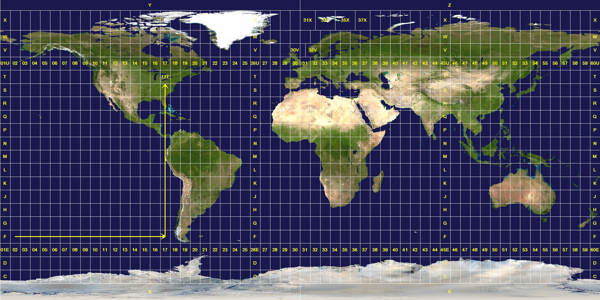
          Well I've been working on understanding coordinate projections.  So any comments on my current understanding is welcome.  Okay, so I think of projected coordinates as two dimensional or a flat piece of paper.  Geographic projected coordinates as three dimensional or spherical and round.  UTM or Universal Transverse Mercator I find to be one of the more confusing geographic projections.  UTM however is the standard for all Federal Agencies so it's not going anywhere.  It's roots lie more in a earth based two dimensional system (Catesian coordinates) and deals more with horizontal representation and from my understanding neglects the earths poles.


          There are different datums for which all different projections of coordinates are based on.  The old datum model, the current datum model and similar datum models.  NAD 27 (North American Datum 1927) was created using the Ellipsoid Clarke model of 1866.   The center of NAD 27 is on Meades Ranch in Kansas.  NAD 83 which is more current and created using the earth centered model of Ellipsoid GRS80.  WGS 84 (World Geodetic System) aligns perfectly with NAD 83 both of these models were created using newer satellite technology and agree on the earth's spherical center point.  I think this is important because the earth is not a perfect sphere and surface altitude comes into play when considering surface location.  The older datum model NAD 27 when aligned with newer models is off by about 150 - 200 feet.  WGS 84 is most commonly used in our GPS units.

Saturday, December 4, 2010

Simple Coordinates Please


          This blog started out for me as simply wanting to put coordinates into my GPS.  In general there are three different formats for coordinates.  Degree Minutes Seconds (DMS) is the most common and widely accepted.  The Degrees are signified by the ° symbol, the minutes by the ' symbol and the seconds by " symbol.  Decimal Degrees (DD) is what the GPS uses.  The whole number in this format is the degree and the numbers after the decimal are a math conversion of the seconds and minutes.  Another format is Degree Minutes (DM) this is in between DD and DMS in which through a conversion the seconds are included with the minutes.  This Wiki article does a nice job of explaining the conversions.  There are many web pages out there to do the conversions here is a reputable one done by the FCC another one that has additional information and is a tool available for Google Earth as well.
          In reading coordinates the latitude is given first and longitude is second.  Latitude ranges from 90° north to 90° south starting at the equator.  If the letter N or S does not follow the latitude coordinate the - symbol indicates south.  Longitude ranges from 180° east to 180° west starting at the Prime Meridian.  If the letter W or E does not follow the latitude coordinate the - symbol indicates West. 
         One degree of latitude is about 69 miles one degree of longitude is about 42 miles.  This web site does a nice job of further explaining coordinates and this web site gets into GPS and coordinates further.

Tuesday, November 30, 2010

Old Map Georeferenced

          Just wanted to share my georeferenced map of the Danville Pottsville rail road.  The railroad was a railroad that just never happened.  Today there are railroad lines that follow similar routes as the old proposed line but they were put in at different times and connected different segments of existing railroad.  The Dansville Pottsville both east and west ends were started but never finished.  The living legacy of this railroad that never existed was and is the Mahoney Plane.  This plane was an engineering feature designed for non-steam powered rail.
           It was interesting and time consuming georeferencing such an old map.  I used stream intersections mostly as reference points.  The actual line seems fairly close to where the actual railroad would have been.

Original Map: Plane and Profile Map by

Kennedy's and Lucca's Lithography, N 3rd Street Philadelphia, 1831


         My georeferenced map of the original map.  One of the streets really makes sense here.  Just above Pottsville in between the light blue line (georeferenced railroad) and the red line (current PA inactive railroad) is a vehicle road.  It is called "railroad street" and is to the left of route 61.  Most likely this is where the short stretch of rail leaving Pottsville was.  Really close for 13 referenced points on a map from 1830!


Georeferencing is an interesting tool!

Wednesday, November 24, 2010

Hike: Nearby Dehart Dam

          Last hike was an interesting one, one that I had never done before.  When going on a day hike you've never been on you're taking a little chance with your day.  It could be a bit of a let down depending on what you're expecting during the short excursion.  Not every hike has a wonderful view or a waterfall at the end.
          The hike "Victoria's Run" did have a nice south west view and a nice steep climb through a conifer zone towards the top.  It's not far from Harrisburg about half an hour or less. heading north on 22/322 and taking Clarks Valley Rd.  Here are the coordinates 40.4218, -76.8618 to the trail head.  I've found using coordinates in Google maps to get to directions to somewhere other than a street address works quite well.

Overhead view
Looking north
Greater area including Harrisburg

          The red line is the AT center line extending from Maine to Georgia.  The blue line is the path I followed with the GPS unit tracking me.  Round trip it was less than four miles and took a little less than two hours with lots of stop time.  The climb was 730 feet.  Hope you get a chance to take the hike!

Thursday, November 18, 2010

Helpful GPS Tool

          We all may have noticed the shortcut "DNR Garmin" on our computer screens in the computer lab.  This application was created by the Minnesota DCNR.  In my hiking blogs I've been using Google Earth and just been wondering how I may get my hiking tracks into ArcMap.  DNR Garmin will allow me to do this and more it seems.  Opening a .gpx (GPS file extension name) with "DNR Garmin" made visible information I knew had to be there such as latitude, longitude, projection, time and altitude.


I'm still very new to this program but it seems it was not really created simply for the task I wanted it to do.  It can upload tracks and waypoint from ArcMap to the GPS unit.  Very interesting.  As I explore a little more with it I will share the information here.

Dasymetric Map

          There are many different ways of mapping data.  One way of particular interest to me is the USDA Plant Hardiness Zone Map.  If you've ever been around gardeners talking gardening from different states one of the first things brought up in discussion is "what zone are you?"  They talk of their favorite plants specimen and like to know if the plants are hardy in the other gardeners zone.  This USDA Plant Hardiness Zone Map is a dasymetric map.  This is a map where the zones are chosen because what is occurring within these zones are similar.  This is different than using existing boundaries like in choropleth mapping.   
          In this map zones refer to the average minimum temperature over a ten year period.  Their are 11 zones separated by a ten degrees Fahrenheit.  The first map put out was in 1960 then 1965 and most currently a 1990 version which breaks the zones into two five degree subcategories.  The USDA has set the standard for this map globally.  There are problems with this map such as they don't take into account summer heat and snow cover which acts as insulation to hibernating roots allowing some plants to survive in colder zones.  Sunset Garden web site attempts to take into account many other environmental factors such as these.  In our area we are generally zones 6a or 6b.  The United States National Arboretum has "clickable" map to see different zones around the United States.

Tuesday, November 9, 2010

HIke: Hemlocks Natural Area

         The last hike I went on was to an area called Hemlocks Natural Area in Tuscarora State Park.  This hike is further south and west than Flat Rock in Colonel Denning State Park and not to far from where the TurnPike passes through the first tunnel traveling west.  The hike is unique, it takes you through a never logged, virgin tract of Hemlock pine.  Hard to see but between the two yellow points are this hike and Flat Rock.


          After the hike I discovered a little more about the Garmin unit that I'm using.  It logs elevation data and more in the .gpx file when running the unit application "tracks".  While in Google Earth I realized this information can be displayed in a convenient chart including your elevation along with other data.  A nice little arrow trails along the track you traveled displaying the information gathered on the Garmin GPS unit.


         This was a truly unique hike.  I did not capture the drive to the spot on Hemlock Road with the GPS unit.  The drive was one of the most interesting segments of this adventure.  At the height of altitude on Hemlock Road (2200ft) you can see Flat Rock (~2100ft) looking (NE) in the distance.  Explore this area ~40°14'06.96, 77°38'39.80.  I did find a shapefile and Google kmz file for the Appalachian Trail which will I will likely include in my future hiking posts.

Sunday, November 7, 2010

Appalachian Trail in PA

          The Appalachian Trail, which is approximately 2,179 miles long is located in the eastern United States  and stretches between Springer Mountain in Georgia  and Mount Katahdin in Maine.  I have always had an interest in exploring different sections of this trail within PA. The trail enters the state at the Delaware Water Gap before crossing Cumberland Valley and exiting in Maryland. Compared to other portions of the trail, PA is known to be somewhat rocky.


          I wanted to include this because many of my hikes I've included in my blogs are on the Appalachian trail or off shoots related to the main trail.  This site is interesting and contains more information on the Appalachian trail.

Marcellus Shale and You?

          Marcellus Shale is having a large financial affect on many people and their lives in Pennsylvania.  The natural gas extracted from the shale is mostly affecting people in northern parts of Pennsylvania and southern parts of New York.

          It is affecting me in an indirect way.  For me it has to do with a family owned cabin in Wayne county.  Recently, we were notified that gas drilling companies would be using our land in return for royalties to drill for natural gas.
          Marcellus shale is a black carbonaceous (organic rich), low density shale that can be found throughout much of the Appalachian Basin.  The shale was named after an outcropping in Marcellus New York.  I find it interesting that the outcrop is nowhere near current production areas.


          The formation can be found beneath about 60 percent of Pennsylvania’s total land mass (as the map above depicts) and the depth ranges between 5,000 and 8,000 feet.  Currently the production is occurring in areas where it can be most easily extracted.  Horizontal drilling is the most common drilling practice used in extraction.  I found a video here that demonstrates the current drilling and extracting process if your interested.


Saturday, October 23, 2010

Some More Global Pollution


          I found this map to be very interesting as it shows the world’s pollution hotspots from an outer space vantage point. The darkest red areas depict the highest concentrations of nitrogen dioxide in the atmosphere. Not surprisingly major cities in North America, Europe and China show very high levels of NO2. Africa and SE Asia have higher concentrations because of the vegetation they burn. Interestingly, if you look closely at oceans between continents you can see a light blue steaks especially around the Red Sea and the Indian Ocean. These streaks are actually ship tracks.
          Nitrogen can be released into the atmosphere a variety of ways. Naturally it can come from lightning; however, more often it comes from burning fossil fuels, industry and vehicles. Large quantities can contribute to array of health issues mainly respiratory in nature.  It can also contribute to ground level ozone which is harmful as well.

Appropriate Point of Reference

http://bigthink.com/blogs/strange-maps

          The above picture depicts BP's “Deep Horizon Rig”, which spilled about 50 million gallons of oil into the Gulf of Mexico. This geographic catastrophe began on April 20th and continued for 86 days. The above map to the right shows how much area was affected by the spill (10, 000 square miles). When looking at the map depicting the spill over the ocean it doesn’t seem quite as ominous as when it is superimposed over a land map close to home.


This site http://www.ifitweremyhome.com/disasters/bp can move the oil blob around for you and explains a little about Mercator projection as well.

Thursday, October 14, 2010

Neat Hike Close to Home

          I was really busy last Sunday, but I did find some time to go on a hike (with my GPS in hand) close to the HACC area.  If you want to find this hike for yourself just drive North on 11/15 and exit at Duncannon and you will notice some fairly impressive mountains the Susquehanna cuts through (water gaps).  I initially found this hike by word of mouth and it took some searching.  It is called "Hawk Rock;" however, there are so many hikes called hawk rock in the Pennsylvania area that it can be quite confusing.  The view from the top is really unique.  Looking north you can see parts of Perry County and the Susquehanna river.  About half way on the hike there is a rock slide as well.  The Appalachian trail passes through this area.  Total distance is just over two miles round trip and can be done in about an hour and a half.  The peak elevation was about 1,100 ft.

View to the North and West
View to the North and East

Monday, October 11, 2010

Too close for comfort?

          With GPS devices becoming more accurate and more prevalent in our daily lives it sometimes makes me wonder where the line should be drawn legally regarding their use.  Recently police put a GPS unit on a suspects vehicle without him being aware of it.  He was convicted and the judgment went in favor of it being legal to trace his movements in this manner.  Pineda-Moreno who was convicted will be taking his case to a higher court.  This case raises many questions.  Is your vehicle private property?  Did law enforcement breach his 4th amendment rights (no unreasonable search and seizures).  Arguments for both sides are made in this article pertaining to this case.
          The cost of GPS tracking units are really quite inexpensive.  I did quick search and I came across GPS tracking units for around a hundred and fifty dollars.  That's fairly inexpensive, as to where almost anyone could afford to own one.  It would not be unreasonalbe for parents to buy tracking devices for their young drivers cars without them knowing or police to track a violent fugitve; however, like many I am torn with the question of, "How far is too far?"
http://www.brickhousesecurity.com/gps-car-tracking-vehicle-logging.html


Sunday, October 3, 2010

A More Accurate GPS Device

      I’ve always wondered just how accurate our GPS devices are.  Frequently they are reported to be accurate to approximately 20 feet.  My Garmin unit says (after acquiring four or more satellites) it is accurate to + - 9ft.  However, over the next 10 years there will be a series of GPS satellites launched to replace each of the 24 existing satellites, which will provide a variety of improvements.  The most recent launch was in Cape Canaveral, Florida on May 27, 2010 when the Delta IV rocket was launched with Global Positioning System GPS IIF SV-1.  The mission of this 10 year project is to receive stronger and more accurate signals, which will bring accuracy within 3 feet and provide a stronger indoor signal.  Increased signal strength sounds good.  Makes me wonder though, could some consider it an invasion of privacy at some point.  Where does it stop?  Here's the rocket launch of the next generation of GPS satellites.  This launch is in English.


Friday, October 1, 2010

Hiking Spot

        In class last Wednesday I loaded the Pub Crawl places into Google Earth and noticed under tools "GPS".  So I decided to experiment with it when I got home.  Google Earth almost effortlessly loaded waypoints and tracks from the Garmin GPS unit.  So here are screen shots of last Sundays Flat Rock Trail hike at Colonel Denning State Park.  It's about a two hour hike round trip and has an amazing view east and west of the valley at the summit.  PA DCNR Colonel Denning.  You can see Pine Grove Furnace State Park which is at southern end of the South Mountain range (facing south).  Interstate 81 and the PA turnpike are visible from the overlook as well. This is a land feature in our area that is said to be easily distinguishable from "space".  The GPS unit max. elevation was 1,975 ft. which is close to the information shown by dragging the mouse over the highlighted track imported into Google Earth.

Sunday, September 26, 2010

Lots of Eyes in the Sky

          On Saturday, September 11, 2010 Japan launched its first GPS satellite the "Michibiki", whose name means showing the way.  This is the first in a series of satellites that will have the intent to improve  accuracy of satellite navigation in the country (more specifically in the islands).  Scientists hope satellite accuracy will be increased as the current satellites strength is diminished by mountains or skyscrapers. This will be a feature which will be widely used by drivers in Japan.  Japan's system (QZSS) is only one of a number of satellite networks in the works by other countries to reduce dependence on the United States built and controlled NAVSTAR GPS network. Because of safety systems and commerce many countries have begun to take control of their own systems; including  Russia's GLONASS, the European Galileo and even China intends on turning its COMPASS network into a global system.  India plans to build a service as well. This isn't to surprising understanding all the growth that is occurring globally.  Foreign nations want to depend less and less on the United States.  This is a lot going on in the sky and makes you think about the United States and our position globally.  Makes me wonder if it's possible to have contention over satellite position in space.


Article

Thursday, September 23, 2010

How do GPS devices operate?


          As summer comes to an end, days become shorter and the bright green leaves change to golden, scarlet, orange and brown. Fall is one of my favorite times of the year to enjoy nature by embarking on outdoor adventures, especially hiking.  Some of my favorite hikes close to home include Flat Rock, Tumbling Run, Pine Grove Furnace, Leigh Gorge and Ricketts Glen (just to mention a few).  Each time I reach the peak of one of these hikes, I look across the mountain ranges and wonder what the elevation is, where I am in relation to home and even how they compare to the mountains I ski during winter. Recently, I was gifted an all-purpose Garmin GPS to use on hikes; even though I only had a chance to bring it along on my most recent hike to Leigh Gorge, it has given me a better idea of the scope of the hike in terms of elevation, distance, longitude and latitude. The top elevation I recorded on this hike was approximately 1,400 feet.  This sparked me to wonder actually how the GPS actually works.  The Global Positioning System depends on 27 satellites 24 of which are in operation and 3 additional satellites in case of failure. These satellites continuously orbit the Earth and transmit the following data:  Time information (each satellite has an internal atomic clock which is accurate to the billionth of a second), Precise orbit information, Rough orbits of other GPS satellites, and System health.

         Each satellite weighs 3,000 to 4,000 pounds and circulates the Earth about 12,000 miles which is 2 rotations daily.  The orbits are arranged so that there are always 4 visible satellite signals.  After these signals reach the GPS device the receiver calculates the distance to each satellite; which is a process called trilateration.

         Does trilateration mean that we only need three satellites to receive an accurate location? If you know your exact elevation you would only partially be correct because there is still the time factor. GPS’s must receive input from four or more satellites (along with elevation) for your position to be be as accurate as possible.  Signals from satellites are three demonsional.  You can think of them as spheres.  The intersecting areas become your location.  The more satellites the more accurate your location. 
           Understanding trilateration is important to understanding how GPS devices operate.  This video on trilateration was helpful to me.  It might be a little long but does a good job of explaining trilateration.  I really think the new GPS gift is going to keep me occupied for a while as I discover all its capabilities.

Friday, September 17, 2010

Around the World

          I recently bought a new used car with about a hundred-thousand miles on it.  In the life of a Subaru that's really not all that many miles if you follow the maintenance guidelines.  For most people mileage on a car is really just a number, an indicator of when to get an oil change or a timing belt replacement.  I myself never thought of it as more than a number until the used car salesman mentioned “ya cars been around the earth about four times”.  I just thought, “Wow!  I'm buying a car that has done that?  The circumference of the earth is 24,902 miles.  Most miles are just driving around town with occasional weekend trips or even possibly a road trip across the country.  I'm sure if you mapped peoples driving habits it really wouldn't be all that interesting.  Just a bunch of really dense lines with random single lines jetting out into open space.  However, the salesman’s comment really made me think a little more about the circumference and spatial details of our planet.

          The circumference of the Earth after Aristotle argued the Earth was round was figured out by Eratothenes circa 200 B.C. He figured the circumference to within a half percent of accuracy.  This really astonishes me.  Not only the accuracy but the simple fact that it was done far before any one had traveled the circumference or without any modern technology to assist him.  To determine this he took measurements of shadow heights in two different parts of Egypt at specific times and then calculated the angle between the two.  From this he was able figure out how big a circle was needed to complete 360 degrees.  Eratosthenes thought that precise mapping really depended on accurate linear measurements.  I really don't think he could have been more correct in this thought.  The amount of perception and mathematical skill Eratosthenes had was truly amazing.  He was also the first person to use the word geography.  In my mind, Eratosthenes made one of the most significant if not the single most important contributions to modern cartography as we know it.